RAYBY KAZEYAMI INNOVATIONS
RAY WATERFRONT / MIAMI
Exit ↗
© OpenStreetMap contributors · Miami-Dade County
1.0×
Preparing the waterfront…
↔ Drag to orbit 360° · Scroll or pinch to zoom
RAY / 3D CAMERA POSITIONS

Move through the scene.

RAY / MIAMI, FLORIDA

Find your way to the waterfront.

BISCAYNE BAYOFFLINE ROUTE OVERVIEW · SCHEMATIC ✈ MIA RAY MIAMI N ↑

Map © OpenStreetMap contributors · Route: OSRM / OpenStreetMap

RAY / A FIRST LOOK

A place to explore.
A story to experience.

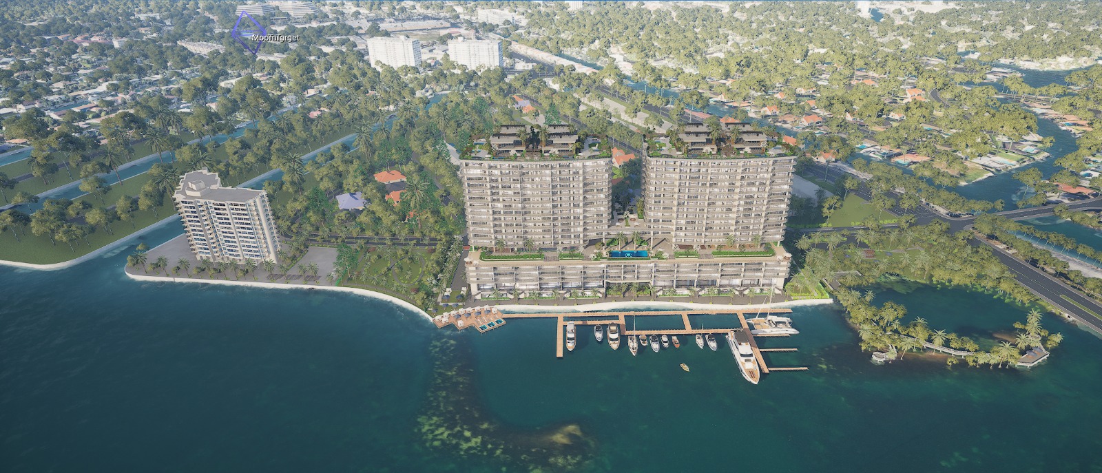
Explore an interactive 3D study inspired by the supplied RAY Waterfront references. Orbit the towers continuously, move closer to the architecture, and discover the waterfront from every side.

Explore
Drag in any direction to orbit the building. Use the arrows to rotate or choose a camera position.
Look closer
Scroll, pinch on touchscreens, or use + / − to move closer and further away.
Set the atmosphere
Change the sun and atmosphere. Pause water, foliage, and boat motion at any time.

Layout: © OpenStreetMap contributors · Building footprints: Miami-Dade County.

Offline route overview is illustrative, not live navigation. Open Google Maps for current directions.

The architecture uses the supplied building model, optimized for this web preview, with added planting, roof gardens and lighting. Roads and surrounding footprints use mapped layout data with clean modeled finishes. Context buildings and landscaping remain illustrative. Interior exploration is not included.

Discuss a RAY experience ↗
Supplied reference view of RAY’s waterfront architecture and marina
WATERFRONT / MIAMI

RAY

A different perspective
on the waterfront.

Explore the twin towers, rooftop gardens and bayside setting in an interactive architectural study.

Reference image shown. 3D files preload in the background. Rendering starts when you enter.

About this study

The preview is ready. Background preload starts after this page loads.

0%